 |
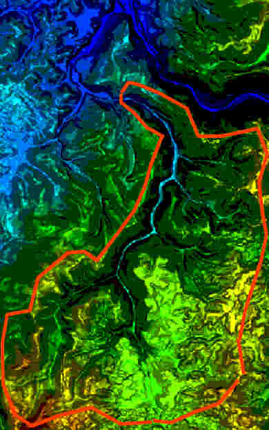
This overlay on
the Digital Elevation Model Map of the Dunbar
Creek watershed shows the approximate boundaries
of the watershed. The entire Dunbar Creek watershed drains an
area of 37 square miles and spans an elevation range of 975 to
2500 feet above sea level. The stream flows approximately
12 miles in its 1,525 foot drop from Chestnut Ridge to the
confluence with the Youghiogheny River. That translates
into an average gradient of 127 feet per mile. In
actuality, much of this drop is concentrated into short
sections of the stream, separated by flats and nearly level
runs. Many of the tributaries of Dunbar have gradients
of from 200 to 400 feet per mile, decorated with frequent
water falls and reflection pools. The Grist Run
and Irishtown Run portions of the watershed have not
been included in this boundary map. |

