 |
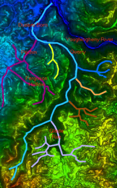
This overlay on
the Digital Elevation Model Map of the Dunbar
Creek watershed shows the approximate locations
of Dunbar Creek and its various tributaries. The
light blue stream in the center, is Dunbar Creek.
The dark blue stream at the north east corner is
the Youghiogheny River. The lilac colored stream
near the south east corner, is Glade Run. The
Delayed Harvest Fly Fishing Only section of
Dunbar creek, runs from the Quarry (indicated
between the river and the "yellow"
tributary) and the confluence of Dunbar Creek
with Glade Run. |

